New
LiDAR RoboSense Fairy

LiDAR RoboSense Fairy

LiDAR RoboSense Fairy
Robosense | A-000000-08045
€1,872.00
20 perc. French VAT inc.

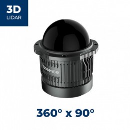
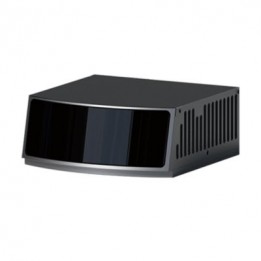
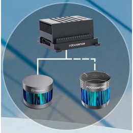
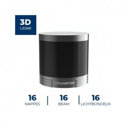
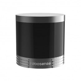
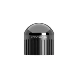
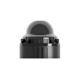
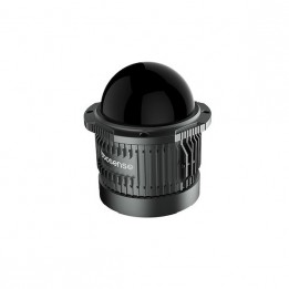
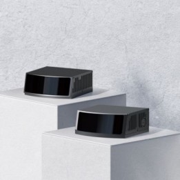
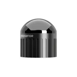
The LiDAR RoboSense Fairy is a digital LiDAR with mid-range performance for 3D perception in mobile robotics and 3D mapping.

Quantity
Delivery within 2 to 3 weeks

Create a cart and turn it into a quote instantly!
Payment methods (see T&C)
Debit card
PayPal
Payment by invoice
Wire transfer

RoboSense Fairy: accurate, dense 3D perception, easy to integrate

Key takeaways

  • Compact, lightweight design (< 350 g / φ75×H70 (mm))
  • Ultra-high accuracy: 0.5 cm
  • High-density point cloud: ~1,370,000 pts/s
  • 150 m range
  • Integrated IMU
  • Ideal for 3D mapping, obstacle avoidance, and autonomous robot navigation

Overview

The RoboSense Fairy is a LiDAR designed for 3D perception in robotics, combining accurate measurements with a dense point cloud. It delivers 0.5 cm accuracy, a 360° × 32° field of view, and a range up to 150 m (including 80 m @ 10%).

Its angular resolution (0.25° (H) / 0.33° (V)) and throughput (up to ~1,370,000 pts/s) support obstacle detection, scene segmentation, and SLAM, even on thin objects. The 10 Hz frequency (adjustable) helps balance responsiveness and computing load.

For integration, it streams data over UDP via Ethernet (100Base-TX / 100Base-T1): 3D coordinates, reflectivity, and timestamp. Time synchronization (GPRMC + 1PPS, PTP, gPTP) is useful for multi-sensor systems (LiDAR, cameras, IMU).

It is well suited for embedded use thanks to < 10 W power consumption and a 9–32 V supply. It is also rugged (IP67 / IP6K9K, -40°C to +60°C) and Class 1 laser safe (940 nm) for shared test environments.

Applications and project examples

  • 3D mapping and reconstruction: dense geometry capture to model scenes (outdoor surveying, structure reconstruction, terrain capture).
  • Autonomous navigation and obstacle avoidance: using the 3D cloud to detect obstacles and secure trajectories (mobile robots in shared spaces, indoor/outdoor tests).
  • Localization and SLAM: integration into a LiDAR localization stack, leveraging timestamps and synchronization for multi-sensor fusion.
  • Multi-sensor fusion: LiDAR/camera/IMU time alignment via 1PPS and PTP/gPTP (perception rigs, instrumented platforms, test benches).
  • Service robotics: integration on delivery robots and cleaning robots when 360° perception and point density are key.
  • Logistics and industrial mobility: autonomous forklifts, navigation in mixed zones, obstacle and curb detection.
  • Drones and lightweight systems: integration on UAVs and portable mapping devices thanks to the compact size and low weight.

RoboSense Fairy LiDAR technical specifications

  • Number of lines: 96 
  • Wavelength: 940 nm
  • Laser safety: Class 1
  • Range: 80 m @ 10% ; 150 m (max)
  • Accuracy: 0.5 cm (1σ)
  • Field of view: 360° × 32° (H × V)
  • Blind zone: ≤ 0.2 m
  • Angular resolution: 0.25° (H) ; 0.33° (V)
  • Frame rate: 10 Hz (adjustable)
  • Points per second: ~1,370,000 pts/s
  • Connection: Ethernet 100Base-TX / 100Base-T1 ; UDP
  • Data: 3D coordinates, reflectivity, timestamp
  • Synchronization: GPRMC + 1PPS, PTP, gPTP
  • Voltage: 9–32 V
  • Power consumption: < 10 W
  • Dimensions: φ75 mm × H70 mm
  • Weight (without cabling): < 350 g
  • Operating temperature: -40°C to +60°C
  • Storage temperature: -40°C to +85°C
  • Protection rating: IP67 ; IP6K9K

RoboSense Fairy LiDAR resources

Customers who viewed this item also viewed